The square, older sectors and outer residential roads differ. Parking, gradient, pavement continuity and frontage belong to the exact address.
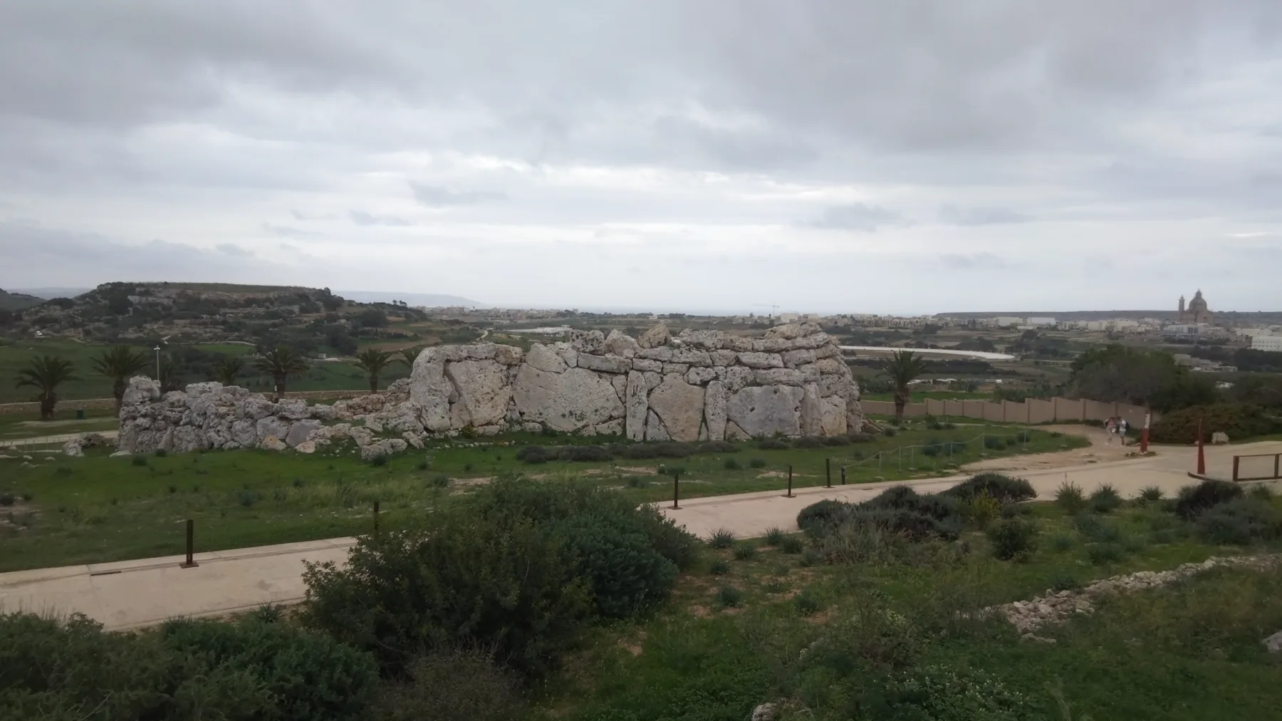
IX-XAGĦRA · GOZOPlateau village.
Plateau village.
Layered history.
Village square, residential streets and major heritage sites share one locality without becoming one promise. The exact block still decides access, outlook and everyday rhythm.
ONE GOZO LOCALITY
Start with the right Xagħra.
Official records place Xagħra in the Gozo Region. Ix-Xgħajra is a separate locality on Malta. Ir-Rabat, Nadur, Marsalforn and Ramla also keep their own identities, addresses and maps.
Ġgantija and Ta’ Kola establish place character. Neither proves admission, a continuous route or a landmark view from every home.
Similar spelling cannot merge the Gozo hill village with the separate coastal locality on Malta.
Prehistory on the Xagħra plateau.
Heritage Malta describes two Late Neolithic structures at Ġgantija, while UNESCO provides the formal World Heritage context. Live access, facilities and tickets belong to the current operator record.
Heritage Malta live site page ↗More than an attraction list.
The Local Council distinguishes historic sectors within Xagħra. This edition keeps the square, streets and daily services legible instead of turning separate sites into a single invented walk.
Xagħra Local Council ↗EVERYDAY CHECKS
Concrete anchors, live details.
These current council, operator and transport sources establish practical context. They are not rankings and do not claim that any destination is nearest to a property. Recheck status, hours and the permitted route directly.
Local Council
The council publishes its office on 8th September Avenue. Current counter services and access belong on the official page.
Council contact ↗Galea Supermarket
The operator currently identifies collection from Xagħra and Marsalforn outlets. Verify the Xagħra location and live hours before travelling.
Galea operator page ↗Current bus directory
Malta Public Transport currently lists Route 307 under Xagħra. This preview freezes no frequency, departure or stop-to-property time.
Live routes and timetables ↗Ta’ Kola Windmill
Heritage Malta operates Ta’ Kola. Check its live listing for current opening, facilities and access rather than relying on an old guide.
Heritage Malta sites ↗PLATEAU & VILLAGE
Four distinct Xagħra visits, with no invented trail.
The archaeological park, windmill, perimeter-only cave and lived hill village have separate operators and access conditions. None is evidence that a property is nearby, overlooks a site or connects by the shortest-looking line on a map.
Ġgantija Archaeological Park
Heritage Malta identifies two Late Neolithic structures on the Xagħra plateau; UNESCO supplies the formal World Heritage context. Use the live site page for admission, facilities and access.
Current Ġgantija page ↗Ta’ Kola Windmill
Heritage Malta documents the windmill as a separate historic house with its own visitor conditions. Do not merge its entrance, ticket or accessibility with Ġgantija or the village square.
Current Ta’ Kola page ↗Ta’ Għejżu Cave
Heritage Malta states that Ta’ Għejżu may be viewed from the site perimeter. That wording matters: it is not an invitation to enter, improvise a path or promise full accessibility.
Official cave record ↗Sant’Anton to tan-Nazzarenu
The Local Council distinguishes older Sant’Anton/tal-Qaċċa, central Xagħret il-Għażżenin and eastern tan-Nazzarenu contexts. An exact address is still required before assigning a home to one sector.
Council geography and history ↗11 CURRENT LICENCE RECORDS
Village and heritage-edge examples, not a ranking.
The MTA's Xagħra filter returned 11 restaurant records when reviewed on 27 October 2026. The examples below show separate settings within the locality. A register entry verifies a licensed name, reference and recorded street—not today's menu, quality, opening or proximity to a home.
Al Sale · Latini · Oleander
The register records Al Sale as RST-23000, Latini as RST-23085 and Oleander Restaurant as RST-12976 at Pjazza l-Vittorja. They are sourced square examples, not an ordered shortlist.
Filtered MTA register ↗The Temple · Ta’ Frenċ
The Temple Bar & Kitchen appears as RST-33296 on Triq l-Imqades; Ta’ Frenċ Restaurant appears as RST-32374 on Triq ta’ Għajn Ħosna. Neither record establishes a route from Ġgantija or a property.
Review all 11 records ↗Check the operator directly
Restaurant status, reservations, dietary needs, price and accessibility can change independently of the licence register. Check the chosen venue's current channel before travelling.
No invented shortcut.
This edition draws no locality boundary, property pin, straight-line walk, bus schedule, car-traffic estimate or taxi price. Visit Gozo publishes an official Ramla walk, but it is not a property route and its geometry and safety context must remain attached to the source document.
Open the locality overview only when you need it.
The map frames Xagħra and surrounding place labels for orientation. It deliberately draws no boundary, route, distance, travel time or listing location and loads from OpenStreetMap only after your click.
Address Registrar · Local Government Division · Xagħra Local Council · Xgħajra Local Council · Visit Gozo · Ġgantija · Ta’ Kola · Ta’ Għejżu · UNESCO · Malta Public Transport · Galea Supermarket · MTA Xagħra restaurant register
No ranking, fixed opening hours, property-specific distance, guaranteed view, parking claim, accessibility promise or locality-wide journey time is implied.
Nexus Marketplace
Explore Ix-Xagħra
See local homes and explore food, shops and everyday places around the neighbourhood.
Homes in Ix-Xagħra
Browse local listingsPlaces around Ix-Xagħra
Mapped places within 2 km of the centre. This can include nearby neighbourhoods.