The council records the town's seventeenth-century foundation and grid. That history does not place a listing on a historic street.
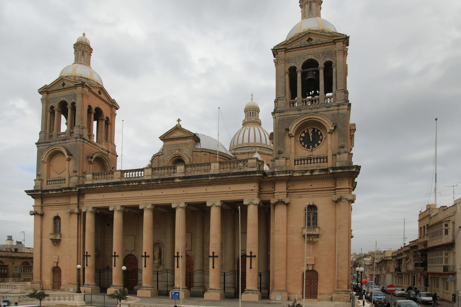
PAOLA · RAĦAL ĠDID · MALTAPlanned streets.
Planned streets.
Deep history.
Paola combines a seventeenth-century civic plan with managed prehistoric sites and a dense contemporary town. Il-Fgura, Ħal Tarxien, Il-Marsa and the Cottonera localities remain separate places.
READ THE LOCALITY PRECISELY
Start with Paola, then locate the street.
The civic grid, basilica, Ħal Saflieni area and Kordin or Corradino context are different parts of one locality. An exact address still determines the everyday street, useful transport and access conditions.
The Hypogeum and Kordin III have separate operating and booking conditions. A heritage record is not an always-open promise.
The broad map centre helps position Paola. It proves nothing about a listing's street, view, parking or walking time.
A town route is not a property journey.
Malta Public Transport currently publishes Route 401 as a Paola circular. Use the live operator page for departures, diversions and connections rather than relying on frozen brochure times.
The exact street answers the practical questions.
Confirm evening traffic, parking arrangement, pavement continuity, entrance access, the nearest useful stop and the actual route to regular errands. A Paola label or locality centroid cannot answer them.
EVERYDAY ORIENTATION
Use durable public anchors, then verify locally.
The council, health service and live transport page provide a responsible first check. Shops, operators and street-level convenience still need current verification.
Paola Local Council
Use the official council site for current notices and local administration rather than freezing service details into a brochure.
Paola Health Centre
Primary HealthCare places the centre at Pjazza A. De Paule. Check its live page for services, eligibility, appointments and opening information.
Route 401
This establishes a current operator corridor only. It does not guarantee a frequency, connection, nearest stop or property-specific journey time.
Verify the exact street
No durable grocery anchor was established in this research pass. Check current shops and the actual walking environment from the property.
ACTIVITIES, WITH ACCESS REALITY
Plan Paola's civic and prehistoric layers separately.
Paola's centre, the Ħal Saflieni Hypogeum and Kordin III are not interchangeable attractions. Heritage Malta manages the two prehistoric sites under different access conditions, while the council and Archdiocese document a distinct planned-town and basilica context.
Grid and basilica context
Read the seventeenth-century plan around the present centre and the Basilica of Christ the King as Paola's urban story. It is not a guarantee that a listing faces the square or sits on a historic street.
Ħal Saflieni Hypogeum
Heritage Malta identifies the underground burial complex in Paola and strongly recommends early booking. Capacity, ticket availability and access conditions must be checked on the live site.
Kordin III
The surviving megalithic site near the Corradino Industrial Estate has its own restricted opening pattern. Treat it as a planned destination and verify the current Heritage Malta schedule before going.
Respect the managed-site rules
Photography, mobility access, group size and admission conditions differ by site. Follow each official visitor page rather than carrying assumptions from one venue to another.
FOOD, WITHOUT RANKINGS
Four register records, not a “best of Paola” list.
The Malta Tourism Authority's current Paola filter returned four restaurant records when rechecked on 27 October 2026. The register supports names and addresses only; cuisine, quality, price, availability and opening hours require a fresh operator check.
Ark Restaurant
The record places Ark Restaurant at 145 Triq Bormla. Confirm its present trading position and current offer directly before relying on the listing.
Trattoria Panormus
The register gives 14 Triq Guze' Damato. This is a verifiable address reference, not an editorial recommendation or a property-specific walking claim.
Silver Spon and Burger King
The same filter lists Silver Spon Bakery & Restaurant at 149 Triq Bormla and Burger King (Paola) on Triq il-Belt Valletta. Recheck both directly for current service.
Open the broad locality overview only when you need it.
The map frames Paola and surrounding place labels for orientation. It deliberately draws no boundary, route, distance, travel time or listing location and loads from OpenStreetMap only after your click.
Malta Address Registrar · Paola Local Council · Archdiocese basilica context · Ħal Saflieni Hypogeum · Kordin III · Paola Health Centre · MPT Route 401 · MTA restaurant register. Volatile access and service details require a fresh check.
Neighbourhood edition. No ranking, fixed opening hour, property-specific distance, guaranteed view, parking claim, accessibility promise, route or journey time is implied.
Continue with the Il-Fgura, Marsa, Ħaż-Żabbar, Żejtun and Valletta editions, or return to all neighbourhoods.
Nexus Marketplace
Explore Paola (Raħal Ġdid)
See local homes and explore food, shops and everyday places around the neighbourhood.
Homes in Paola (Raħal Ġdid)
Browse local listingsPlaces around Paola (Raħal Ġdid)
Mapped places within 2 km of the centre. This can include nearby neighbourhoods.