Check the property's real route to Triq ix-Xatt, including crossings, gradients and the entrance you would actually use.
GZIRA · THREE CONTEXTS
Harbour edge, lived-in streets.
Read Gzira in layers: the promenade and Triq ix-Xatt, the everyday streets behind it, then Manoel Island as its own heritage context across the bridge.
 GZIRA EDITION
START WITH THE EXACT STREET
One locality, different daily patterns.
The Local Council places Gzira along Marsamxett Harbour and links its name to Manoel Island. That shared identity does not make every address a waterfront home or put every daily service within the same walk.
The residential grid behind the harbour needs its own pharmacy, grocery and transport check rather than a waterfront assumption.
Fort Manoel and the Lazaretto are valuable context, but Manoel Island is not a substitute label for the whole of Gzira.
Orientation, not a promise.
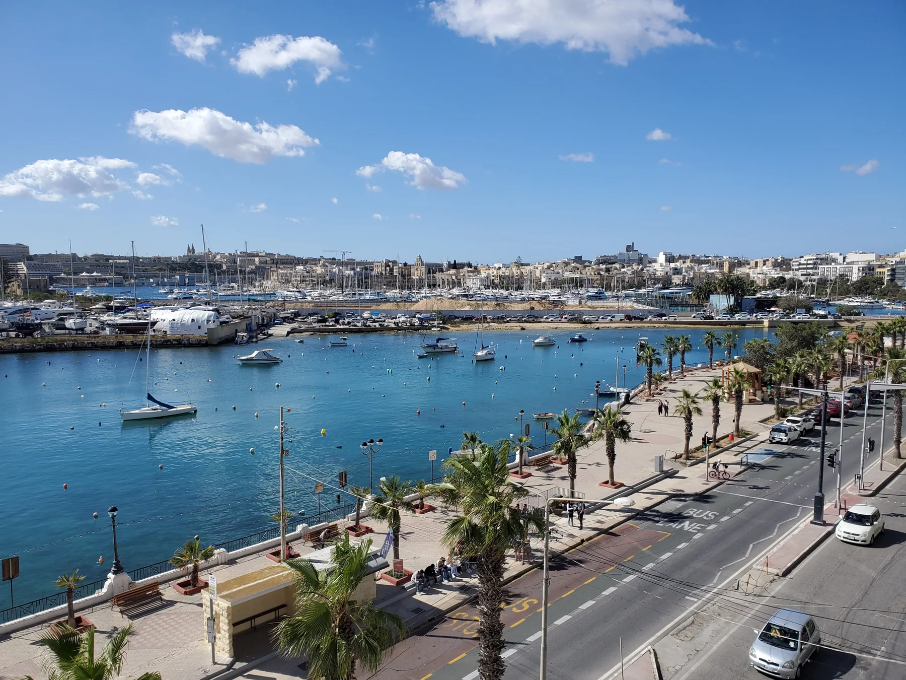
The promenade photo shows the harbour-facing edge, street and marina context. It does not prove a sea view, quiet interior, available parking or a short commute for any listing. Those claims require the exact property.
Gzira Local Council ↗Heritage across the bridge.
The council documents Fort Manoel and the Lazaretto as part of the island's history. This edition treats them as a distinct area reached from Gzira and draws no shortcut, access promise or finished heritage trail.
Council geography and history ↗OFFICIAL AND OPERATOR-VERIFIED EXAMPLES
Everyday anchors, without a ranking.
These examples help place practical life around Gzira. They are not claims that a venue is the best, closest or suitable for every property, and current hours remain on the linked source.
Gzira Health Centre
Primary HealthCare lists the centre at Meme Scicluna Square and shows a wider service catchment beyond Gzira.
Official centre information ↗The Convenience Shop
The operator lists a Gzira shop on Triq Sir Frederick C. Ponsonby with everyday grocery lines.
Operator information ↗O'Hea Pharmacy
The operator lists pharmacy and clinic services at 115 Triq Manoel De Vilhena.
Operator information ↗Gzira Local Council
The council publishes its office contact and current locality notices. Check the live page for the service or appointment you need.
Official council page ↗FOUR DIFFERENT WAYS TO READ GŻIRA
Look closely before calling every address “waterfront”.
These are orientation prompts, not a route or a checklist of attractions. Access, crossings, construction and opening conditions must be checked for the day and the exact entrance.
Read the promenade in person
Triq ix-Xatt is Gżira's visible harbour-facing edge. Observe crossings, traffic, shade and the actual building entrance instead of transferring the hero image to an inland listing.
Council locality context ↗Walk the lived-in grid
The council describes an older core of houses and balconies alongside modern development. A slow street check reveals a different daily setting from the marina-facing frontage.
Council geography and history ↗Keep the island distinct
Fort Manoel belongs to the locality's documented heritage, but its island setting does not make every Gżira property a heritage or waterfront address. Verify current public access separately.
Documented heritage context ↗Context, not an access promise
The council also records the Lazaretto on Manoel Island. This page makes no claim that restoration, paths or interior access are complete or open on the day you visit.
Council source ↗23 CURRENT LICENCE RECORDS
Restaurant examples by street, never a ranking.
The MTA's GŻIRA filter returned 23 restaurant records when reviewed on 27 October 2026. A record supports the licensed name, reference and recorded address only—not quality, menu, opening, booking availability or proximity to a home.
Aqualuna · Felice
Aqualuna Lido Restaurant appears as RST-24261 and Felice Brasserie as RST-29429 on Triq ix-Xatt. They illustrate the waterfront axis, not an ordered shortlist.
Filtered MTA register ↗Kassik · Saigon
The register lists Kassik as RST-28519 at 337 Triq D'Argens and Saigon as RST-32172 at 305 Triq D'Argens. Current service and menus require an operator check.
Review all 23 records ↗Aladdin · Ali Baba
Aladdin is recorded as RST-28517 at 24 Triq Sir Frederick C. Ponsonby and Ali Baba as RST-17672 at number 9. The licences establish no walking route from a listing.
Current Gżira filter ↗No line across the harbour.
This page draws no walking route, ferry route or commute time. Walking geometry, bus timetables, current car traffic and ferry operations are separate sources and must be checked from the exact origin, destination and observation time.
Open the Gzira map only when you need it.
The map includes the inland core, waterfront and Manoel Island for orientation. It deliberately draws no council boundary, route or journey time and loads from OpenStreetMap only after your click.
Gzira Local Council · Council geography and history · Office of the Address Registrar · Primary HealthCare · The Convenience Shop · O'Hea Pharmacy · MTA Gżira restaurant register
No ranking, fixed opening hours, property-specific route, accessibility promise, guaranteed view, parking claim or locality-wide journey time is claimed.
Nexus Marketplace
Explore Gżira
See local homes and explore food, shops and everyday places around the neighbourhood.
Homes in Gżira
Browse local listingsPlaces around Gżira
Mapped places within 2 km of the centre. This can include nearby neighbourhoods.